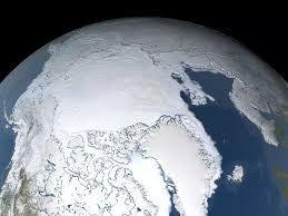
Daily Current Affairs / A new map of the Arctic Ocean reveals an area as large as twice the size of France and six times that of England
Category : Miscellaneous Published on: February 10 2025
Jannik Sinner defeated Jiri Lehecka to complete the historic Sunshine Double at Miami Open 2026 without dropping a single set.
Read More....AIIMS New Delhi alumna Nisha Mehta was sworn in as Nepal’s Health and Population Minister on March 27, 2026.
Read More....India hosted a major maritime security exercise under IONS in Kochi and assumed chairmanship for 2026-2028 term.
Read More....Mahavir Jayanti 2026 is being celebrated with great devotion today on March 31, marking the birth anniversary of Lord Mahavir.
Read More....Jammu & Kashmir’s 19-year-old Sheetal Devi was named Para Archer of the Year 2025 by World Archery.
Read More....Popular Bengali actor Rahul Arunoday Banerjee died at 43 in a tragic shooting accident near Digha coastal town.
Read More....Raymond Group former Chairman and Padma Bhushan awardee Vijaypat Singhania passed away at the age of 87.
Read More....Adani Defense delivered the first batch of 2000 ‘Prahar’ Light Machine Guns to the Indian Army, 11 months ahead of schedule.
Read More....The Union Government launched the Amrit Bharat Station Scheme for redevelopment of 1338 railway stations across India.
Read More....Sunil Narine became the most-capped overseas player in IPL history with his 190th match for Kolkata Knight Riders.
Read More....